I return to the river bedhampton on a geographical study. A small break inbetween the weather fronts allowed precious time to start a survey into the river bedhampton, arriving at the mouth for 10:30 (low tide)

Here we see the rivers mouth which flows into Langstone harbour to the east side of Portsmouth and a confluence with the river brockhampton (A much smaller river that originates from brockhampton springs just one mile north of here)

Here is a screen shot of the lower stage and rivers mouth at >5 meters above sea level

A banded snail peacefully awaits the next weather front

In the saltwater estuary animal life is rich and supports ducks, cormorants, swans and fish like school bass and grey mullet.

Bedhampton quay is responsible for importing large amounts of concrete, aggregate and shale as well as smaller quantity's of sand, gravel and Buxton lime for the local company Tarmac Ltd.

Back to the point, at low tide the river narrows down to only a few meters across and turns brackish.

Continuing up the river, wading birds can be seen on the mud banks preening the mud for any unfortunate shellfish or ragworm.

The river soon becomes non tidal and freshwater as it approaches the A27.

The river skims inbetween bedhampton and brockhampton, running at 5 meters above sea level.

it veers off into private property.


On the other side life flourishes with kingfishers, frogs, herons and wagtails.

Clean water rushes in from the waterworks.

A Grey wagtail scans for insects above the waters surface.

Looking downstream
Looking upstream

The river enters its middle stage as it passes through bedhampton estates, hence the name river bedhampton. It currently runs at 10 meters above sea level.

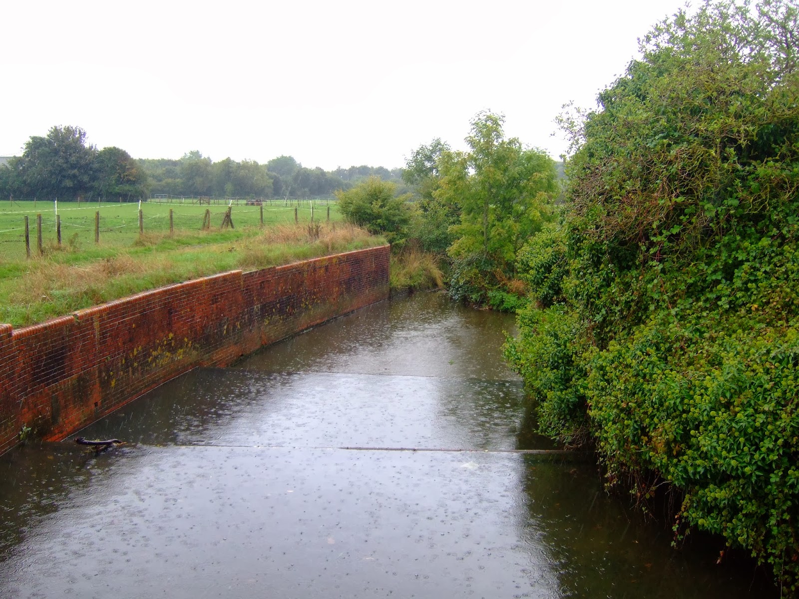
The river is channelled to prevent flooding to nearby estates. (looking downstream)

(Looking upstream) Wildlife is restricted in this part of the river in bedhampton.

Thuther on by the small suburb of stockheath the Fauna return's.

The water flows though hermits lea park

Despite the amount of pollution and rubbish in this section of the river mallard ducks live here in large numbers.

The river then meets its biggest tributary at a confluence. The tributary continues for an extra mile north through Staunton country park and to its source in gammon hill (40 meters high) near the small village of Durrants.
The river now enters Leigh park estate (the largest estate in Europe) Where it gains the name of hermitage stream. In this section the erosion rates are quite strong as the water flows through a concentrated ditch and is almost 15 meters above sea level.

(looking downstream) The next weather system had began to arrive bringing in lots of heavy rain and gusty winds.

'Hermitage stream' has undergone a large operation to restore wildlife diversity in the area and has had its concrete defences removed, the environment agency plan to create artificial meanders here.

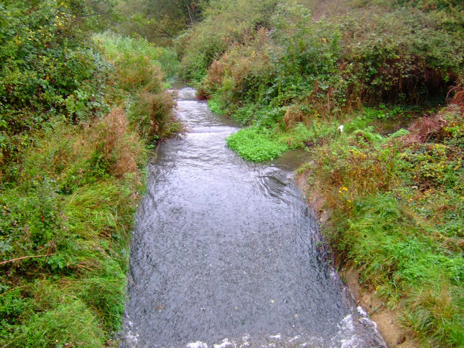
We now entered the 'Rapids' section of the stream were it had its concrete defences recently removed, and combined with the heavy rainfall it was only a matter of time before the river banks flooded as Water Volume increased.

The stream overloaded with extra precipitation discharge, started overflowing at quite a fast rate.

Before long the water levels rose dramatically flooding the Flora around it.

Looking upstream towards waterlooville and the rivers source in the 'queens enclosure' woodland, which is connected to dunsbury hill (50 meters high).

At this point bad weather forced us to cease activity on the 13th of October And conclude My uneventful trip up the River Bedhampton / Hermitage stream.
No comments:
Post a Comment