Thursday, 19 December 2013

Atlantic Depression 'Emily' 19.12.13

I have always been interested in Meteorology and weather photography, partly because of the thrill and the inspiration a 'storm' gives.

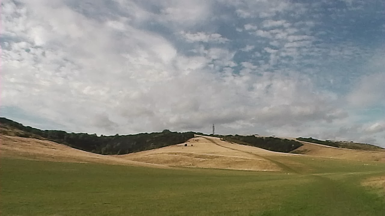
This post is about the Frontal storm dubbed "Emily" which developed along a nasty weather system, with a wet/mild warm front moving in from the west and a thin yet nasty coldfront-low just behind. Both fronts had gained strength over the Atlantic ocean on the 17th December but the coldfront now had potential to turn into a Thin Lewp (line echo wave pattern) type storm.

During the 18th as the system drew ever closer wind speeds gradually picked up throughout the day, heading north towards the centre low. At this point the system was upgraded into an Atlantic Depression.

Towards the early evening the depression hit Ireland causing some localised flash flooding along some of its west coast. Here is a radar grab at around 17:30 with the warm front being the more obvious of the two, many forecasters didn't expect anything serious to happen.
Radar grab-18:30// 1hour later it travelled east into wales and caused Hundreds of homes to lose power when 70mph gusts disabled a large grid switching centre in Cheshire. At this point the storm suddenly increased strength and precipitation rates reached 70mm/hr.
Radar grab - 19:00// The warm front began to move north, and the coldfront had rapidly strengthened into a LineEchoWavePattern with the capability to produce misocyclone's and tornado's up to an F1.
By 19:30 The Warmfront had arrived the Hampshire county, Bringing moderate to heavy rain associated with strong southerly winds and violent gusts. To feel the full effect of the wind on the waves, I headed down to the overflowing Canoe lake in Southsea, Portsmouth.
 
Canoe Lake used to be connected to the sea as a Wetland known as the Great Morass until 1886 when it was blocked off by concrete embankments, today all that connects the sea to the Lake is a Tide suppressing Water Pipe. Wildlife here is restricted with small bait fish and shrimps making the majority of life in Canoe lake, also Shore crabs and More Recently Moon jellyfish populations have been discovered.
 
This was a rare occasion as Canoe lake is only marginally affected by the tide and precipitation runoff usually has little impact on the water volume here.
 Nasty 50mph gusts Rocked the ancient large Oak tree's surrounding canoe lake.
With the Warmfront clearing off to the east, this left a 10minute gap inbetween the two fronts and taking the risk I headed to the derelict Old Portsmouth District to view the waves in full glory.
 Photography is very tricky while being blasted by shingle, sea spray and 60mph winds!  
 Large Swell Waves Battered the sea defences even as it was Low Tide!
 Brittany Ferries Mv Armorique Braves the odds on a rare winter service to st Marlo, France, Replacing the inadequate Mv Bretagne.
 At this point the Cold front suddenly Arrived and wind speeds quickly picked up again, the sky's opened up to freezing cold rain which slowly forced me to retreat to shelter. Gusts of 64mph were recorded at this point as all hell broke lose.
I left Old Portsmouth shortly after (20:00), concerned for my safety and returned home.
Here Is a pressure chart, courtesy of the Met office taken at midnight.
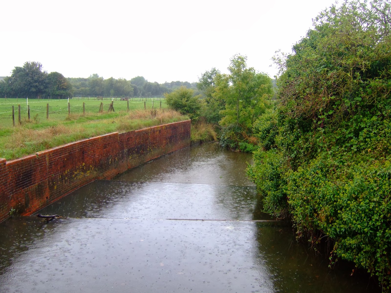
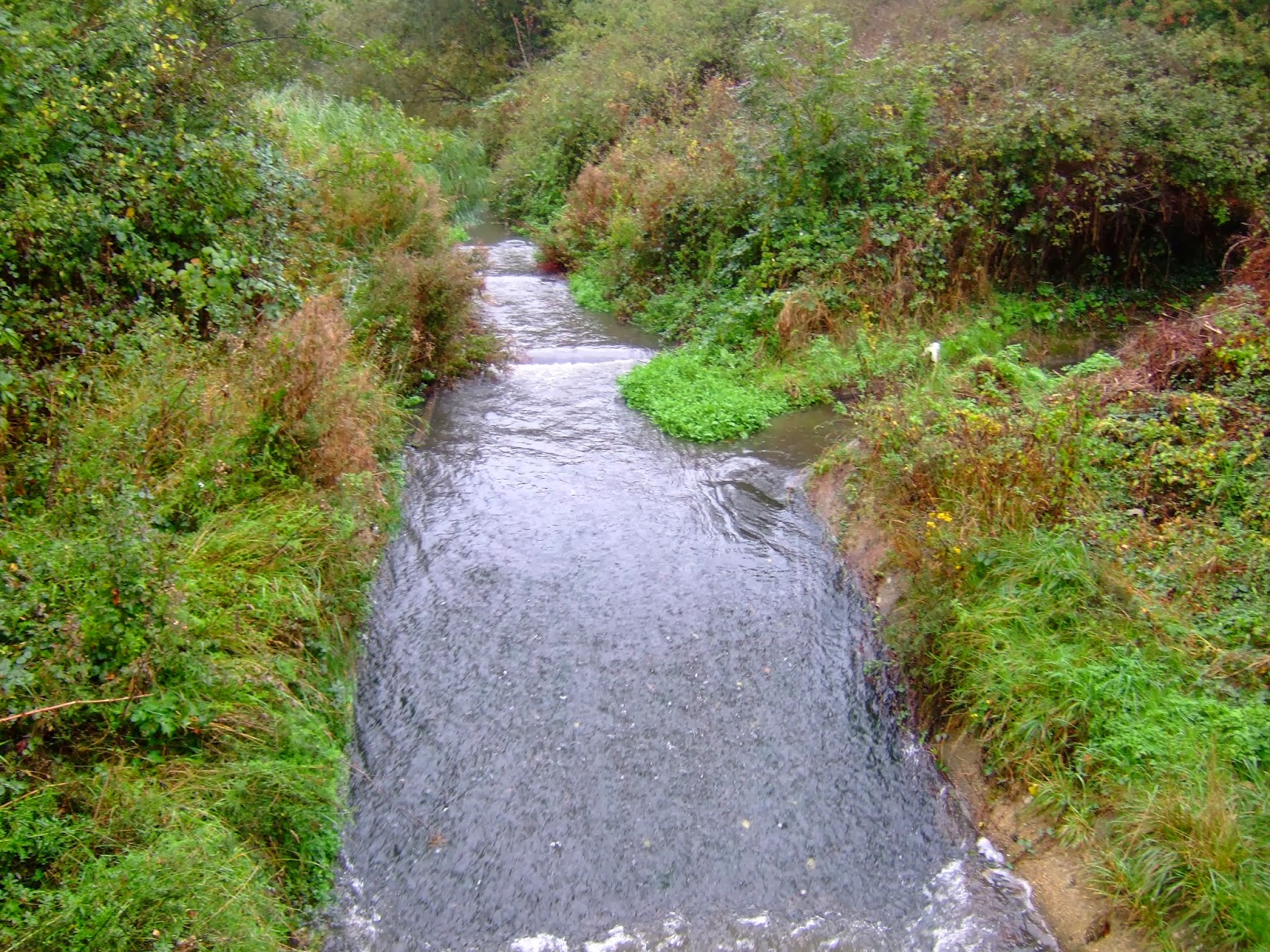
The storm left flooding in the Bristol channel and several large rivers along the South coast. The gales killed two people in the north of the uk and cut power lines leaving thousands without electricity. The LEWP Spawned a Possible tornado over Whitehaven, Cumbria. And more severe weather has been forecasted in the weeks to come. 


Monday, 9 December 2013

Browndown Beach + The River Alver 08/12/13

As Part of a Geographic study I visited Browndown beach and the lower stage of the River Alver.
The weather Correctly forecasted Strong South Westerly winds and sunny intervals, Deciding not to miss an opportunity I arrived at The location just after midday. This Trip comes days after a violent storm surge swept through from the north sea sparking mass evacuations on the East coast near London and localised flooding here on the south*.

Browndown beach + Park Is a Rarely used Military Training ground owned by the MOD and used by the territorial army and Marine's For occasional Training exercises and Training. On the other hand its a great haven for migrant birds arriving late in the winter.

The River Alver originates from a very small catchment in the Gosport Borough with its source In Speedfields Park, Collingwood (10m high). As it heads south an leaves its upper course it is joined by several Tributary's Near the settlement of Rowner, Here the wildlife is said to flourish with sea trout and various other species of fish living here.

The Mouth of The river Alver Was removed to prevent Tidal flooding and replaced by a tunnel.
 The tunnel remerges again 20 yards north, The digger in the background was reinforcing the embankment flood defences here in preparation for The North_Sea_flood_of_2013*.
Looking upstream, Its here were the first tributary Branches off.
That Tributary soon eases into a small Mudlake, Note: strong erosion in the background.

Two Partnered Resident Mute swans search the River Alver for sustainable food, despite the tall embankments Fauna and Flora Continue to grow here steadily. 
The view north as the River Alver heads into its middle course (5 meters above sea level) 
I then decide to explore the rest of Browndown Park
 The Military fortifications in the distance
Among the Birdlife was Rooks, greenfinches, great tits and reports say a locally Rare Dartford Warbler (Dartford_Warbler) was also on site at the time.
Rosehips, Gorse and Thistles were Just some of the Diverse plant life living in Browndown reserve 
 The Main shingle beach on site doesn't share as much life as the reserve, seen here looking 'abandoned'
I Conclude my trip at the Main Military Compound (Former Gun battery).
 First built here in 1842 the gun batteries were designed to protect Southampton from attack by enemy warships, it was highly criticised by Sir James Fergusson And over the years kept needing upgrading until 1905 when it was disarmed. 


Tuesday, 26 November 2013

Butser Hill 26/11/13

Being a sunny day in Mid November and temperatures up to high's of 8 degree's Celsius, I decided to make the most of it and head up to the 'Peak' of Butser hill.
 
Butser hill is a Chalk Hill and holds the second highest Peak in the south downs (The other being Blackdown). It stands at 271 metres (889 ft) high and towers over the neighbouring Market towns like Petersfield and Clanfield. It was Mined for quantities of Lime back in the 1950's and 60's and has one of the richest flora and fauna in Hampshire with many "Rare species of Butterfly hibernating nearby and is in the drainage basin for the Criddle Stream (A tributary of the River Rother).
 
 
 Grasshoppers were high In numbers
Herds of sheep Graze Gracefully enjoying the Sun while it lasted.

The 30 Minute Walk Posed a small challenge but was Easily do-able. The BT Telecoms Tower In the background Makes the Hill easily noticeable From miles around.
 The 200 sheep Here on the Reserve are speckled face Beulah ewes (Originating from Wales this Breed of Domestic sheep can elsewhere only be seen around Abergwesyn,Wales.
 The view from near the Top overlooks; From left to right /War down Hill (244 Meters high) /Windmill Hill (190 Meters high) and Cross dyke (240 Meters high).
 
 The hill has the most Rich chalk grassland in the south and as a result it has lots of diverse plant life.
Near the Peak height Which is next to the telecoms tower 
The Town of East Meon Church greeted us from the other side but by now an Overcast was making itself present As Dusk drew in closer.
 
Before long It was time to head back so I conclude the trip with some distant sun beams.

Sunday, 13 October 2013

River bedhampton: heading upstream 13/10/13

I return to the river bedhampton on a geographical study. A small break inbetween the weather fronts allowed precious time to start a survey into the river bedhampton, arriving at the mouth for 10:30 (low tide)
Here we see the rivers mouth which flows into Langstone harbour to the east side of Portsmouth and a confluence with the river brockhampton (A much smaller river that originates from brockhampton springs just one mile north of here)

Here is a screen shot of the lower stage and rivers mouth at >5 meters above sea level
A banded snail peacefully awaits the next weather front
In the saltwater estuary animal life is rich and supports ducks, cormorants, swans and fish like school bass and grey mullet.
Bedhampton quay is responsible for importing large amounts of concrete, aggregate and shale as well as smaller quantity's of sand, gravel and Buxton lime for the local company Tarmac Ltd. 
Back to the point, at low tide the river narrows down to only a few meters across and turns brackish. 
Continuing up the river, wading birds can be seen on the mud banks preening the mud for any unfortunate shellfish or ragworm. 
 The river soon becomes non tidal and freshwater as it approaches the A27.
The river skims inbetween bedhampton and brockhampton, running at 5 meters above sea level.
it veers off into private property.


On the other side life flourishes with kingfishers, frogs, herons and wagtails.
Clean water rushes in from the waterworks.
A Grey wagtail scans for insects above the waters surface.
 Looking downstream
Looking upstream
The river enters its middle stage as it passes through bedhampton estates, hence the name river bedhampton. It currently runs at 10 meters above sea level. 
The river is channelled to prevent flooding to nearby estates. (looking downstream)
(Looking upstream) Wildlife is restricted in this part of the river in bedhampton.

Thuther on by the small suburb of stockheath the Fauna return's.
The water flows though hermits lea park
Despite the amount of pollution and rubbish in this section of the river mallard ducks live here in large numbers.

The river then meets its biggest tributary at a confluence. The tributary continues for an extra mile north through Staunton country park and to its source in gammon hill (40 meters high) near the small village of Durrants.
The river now enters Leigh park estate (the largest estate in Europe) Where it gains the name of hermitage stream. In this section the erosion rates are quite strong as the water flows through a concentrated ditch and is almost 15 meters above sea level.
(looking downstream) The next weather system had began to arrive bringing in lots of heavy rain and gusty winds. 

'Hermitage stream' has undergone a large operation to restore wildlife diversity in the area and has had its concrete defences removed, the environment agency plan to create artificial meanders here.

We now entered the 'Rapids' section of the stream were it had its concrete defences recently removed, and combined with the heavy rainfall it was only a matter of time before the river banks flooded as Water Volume increased.
The stream overloaded with extra precipitation discharge, started overflowing at quite a fast rate.
Before long the water levels rose dramatically flooding the Flora around it.
Looking upstream towards waterlooville and the rivers source in the 'queens enclosure' woodland, which is connected to dunsbury hill (50 meters high).
 At this point bad weather forced us to cease activity on the 13th of October And conclude My uneventful trip up the River Bedhampton / Hermitage stream.